Field Engineering Report · 2026-06-09
Reading the Ground — terrain that a soldier can traverse, see through, and fight from
The valley map looked alive but quietly lied about itself. Half the walkable ground was stranded behind cliff bands the squad could never reach; the footpaths were a 5-metre paint smudge; a 56° rock wall was drawn the same warm tan as a meadow; and the cover that decides a firefight was a single averaged number per cell, decoupled from the rocks you could see. This pass made the ground honest — and proved every change with a headless probe, a before/after number, and a balance run.
00The bar, and how this was worked
Four asks from the owner, taken literally: humans should be able to traverse up steep terrain; passable terrain should be most of the map and impassable terrain obvious; more footpaths, scaled correctly and molding to the terrain; more on the map to use for cover and tactics. Each became a number on a fresh headless probe, baselined on HEAD before a line changed, then re-measured after every isolated change. Nothing shipped on a hunch — the one change that felt right and measured wrong was reverted (below), and the one that looked fine in the metrics but ugly in a render was caught and rebuilt.
01The map was half-stranded — connectivity, not climbing
A new probe (scripts/passability-probe.ts) floods the valley from the gate the exact way the mover does (8-connected, anti-corner-cut) and asks two questions: how much of the map is passable, and how much is actually reachable. The answer reframed the whole problem:
80% of the map was passable, but only 48% was reachable. The hard "no foot traffic above 51° slope" cutoff wasn't just blocking the odd climb — the 5-metre roughness noise salt-and-peppered fake cliffs across otherwise-climbable faces, shattering the walkable ground into ~5 disconnected islands. Nearly half the map you could stand on, you could never walk to.
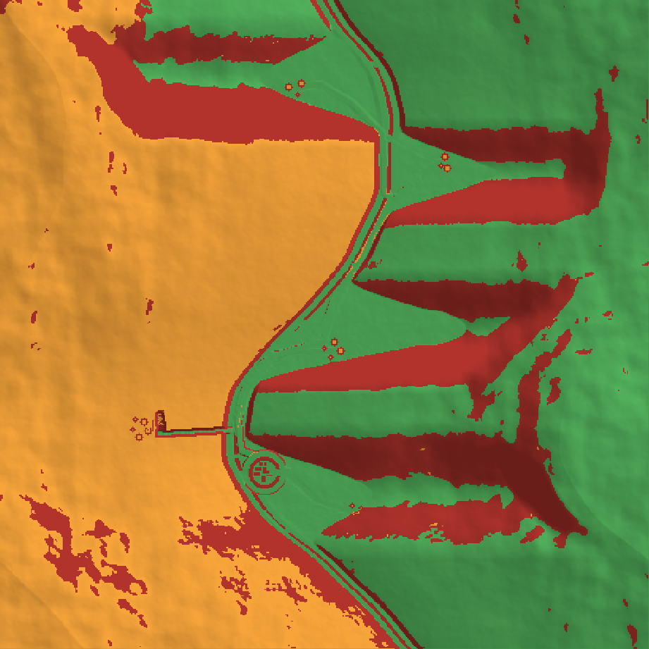
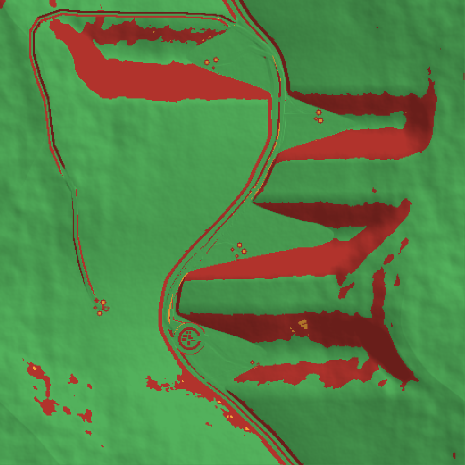
reachablepassable but strandedimpassable cliff
The fix — and the restraint that made it safe
The foot-impassable line moved from slope 1.25 (≈51°) to FOOT_CLIFF_SLOPE = 1.40 (≈54.5°): the 1.25–1.40 band of Rock/Scree faces becomes climbable-but-slow, while the genuine cliffs (≥1.40, and the Land.Cliff classification at ≥1.5) stay hard barriers. Two details made it land where a previous attempt on this exact problem was reverted for stalling movement:
- Global, one source of truth. The change is in
passableCell— the single predicate the planner and the mover both call. The reverted attempt had softened the planner's view while the mover stayed strict, so the planner walked a man at a cell he couldn't enter → wedge → re-path → freeze. With one truth there is no divergence to freeze on. - An anti-speckle guard. A lone walkable cell ringed by cliff is a fake foothold; a 3×3 mean-slope test rejects it, so the mover is never delivered to a one-cell trap.
Measured · 8-seed tune set
| metric | before | after | note |
|---|---|---|---|
| gate-reachable map (reach%) | 48.0 | 60.6 | biggest passable component 64→70% |
| village route-quality / loopy | 1.13 / 0% | 1.12 / 0% | existing routing unchanged |
| river banks-split / traps | 0% / 0 | 0% / 0 | river connectivity preserved |
| balance 12×50 — US WIA / KIA | 3.75 / 1.42 | 3.50 / 1.25 | combat unmoved (slightly safer) |
02More footpaths, the right size, molding to the ground
The valley had one straight goat-trail stub per village and nothing climbing the walls. Added a switchback trail generator (ascendTrail): from every reachable trailhead it climbs the local spur toward an OP shoulder by hairpins, gaining ~150 m and always stepping on passable ground (it deflects along the contour at a cliff and ends cleanly when boxed — a real trail dead-ends at a cliff, it doesn't cross it).
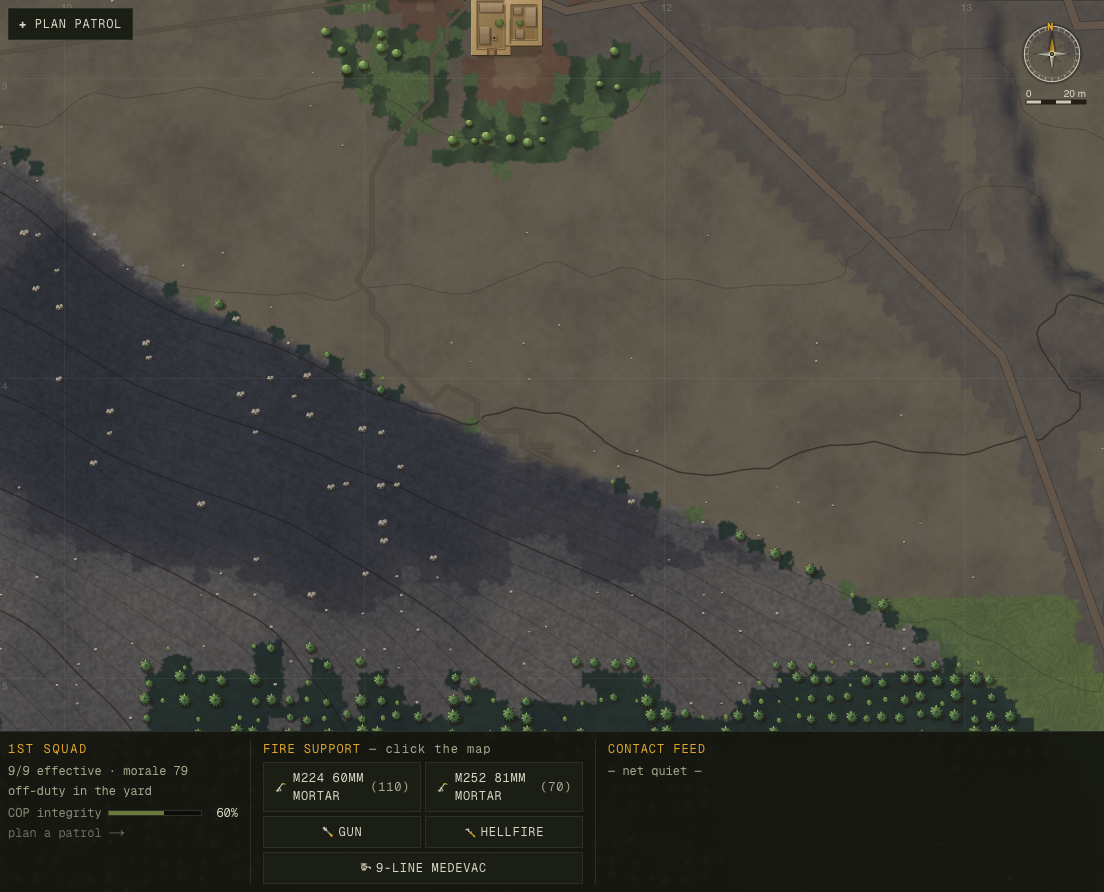
Every path's centerline — the MSR, the village tracks, the COP access road, the goat trails, the new climbing trails — is now captured at generation, so the renderer can stroke each as a scaled line at its real width (a ~4.5 m graded road with a dark cut-casing, a ~1.3 m goat trail as a single faint thread) that molds to the ground it was laid on — replacing the old 5-metre landcover tint that was both too wide for a footpath and nearly the colour of the dirt around it.
03Impassable terrain, made obvious
Cliffs were drawn the same warm tan as walkable scree — a 56° wall and a 30° meadow only differed by hue. The relief bake already computes a per-pixel slope; above the foot-passable line the face now goes cool slate, deep shadow, desaturated — a sheer rock wall, visibly distinct from the dusty slopes a soldier can cross. The threshold is the same FOOT_CLIFF_SLOPE the simulation blocks on, so the picture tells the truth: where it looks like you can't go, you can't.
04Cover — the rock you see is the rock the engine knows about
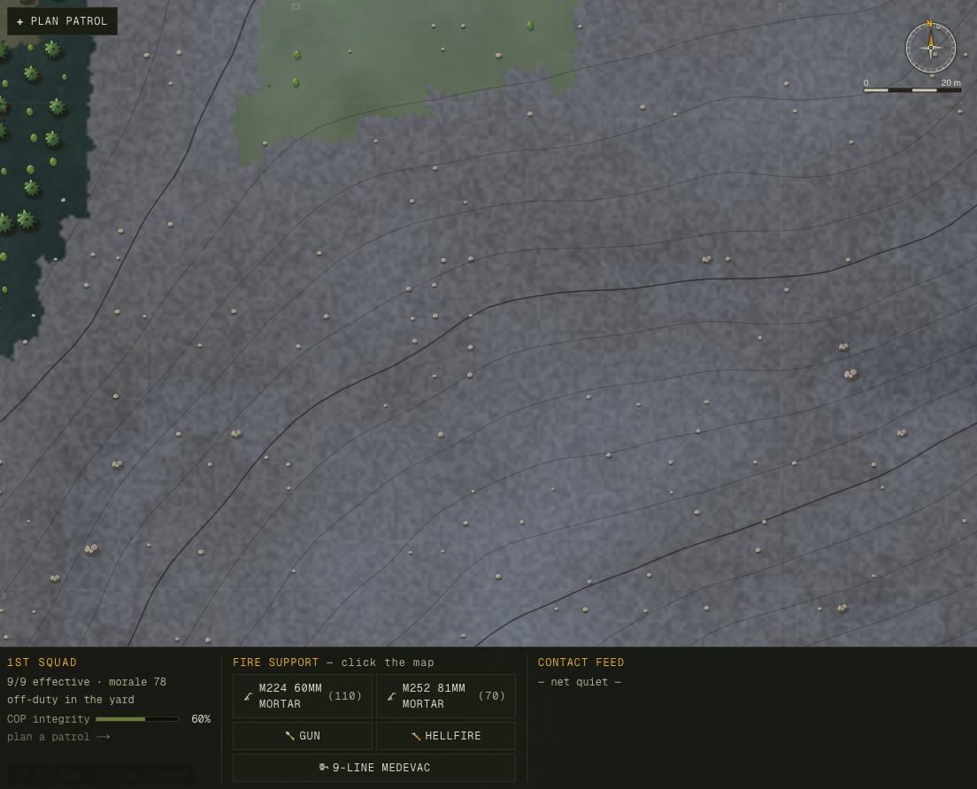
Cover was a single averaged scalar per 5 m cell, and the drawn boulders were a cosmetic overlay scattered independently — so the rocks on screen had no relationship to the number that decides a firefight. Now boulders and rock outcrops are sim objects (terrain.coverObjects): a single deterministic source of truth that the renderer draws. On rocky ground, where the landcover already encodes real cover, that closes the loop — the rock you see is exactly where the engine's cover is (verified per-object in cover-probe.ts). And the owner's "more on the map" is delivered: ~11,600 objects including a strew of erratic boulders down the open slopes that were bare before.
stampNew seam is left in place for the real fix: sub-cell directional cover (behind this rock, exposed from that angle), which can be both usable and non-grinding. That's the honest half of issue 020; the heavy half is scoped, not shipped.05How it was verified
Three new probes were written for this pass and kept (passability-probe, footpath-probe, cover-probe), each opening with a doc-comment naming the bug it metricizes. The standing gates ran green at every step: tsc --noEmit, npm run build, smoke (no-NaN + serialize round-trip), and a 12-deployment balance run for casualty + stall regressions. Determinism is a contract here — every change is a pure function of the seed-built terrain (no new persisted state, no new RNG draws), confirmed by same-seed hash equality. And the connectivity win was re-confirmed on a held-out seed tail (survey-40..59) the changes were never tuned on: reach% 57.5 (tune-set 60.6) — no curve-fit.
06What was left undone, honestly
- The switchback efficiency residual. You can now reach the high ground; the route up an arbitrary peak OP still meanders (the isotropic planner). The clean fix — a directional-grade cost + turn-penalty planner — is now de-risked (the global passability change removed the freeze that reverted it before) and is the next measured follow-up (issue 019).
- Deeper terrain ecology. Aspect-driven vegetation, stacked contour terraces, denser qalat wall-mazes, and flow-accumulation hydrology remain open (issue 007) — each reshapes slope/cover and wants its own balance-revalidated pass.
- Sub-cell directional cover. The cover objects stamp the cell they sit in; true "behind this rock, exposed from that angle" sub-cell cover is the heavier vector-LOS rebuild scoped in issue 020.
Commits: 7b24c19 reconnect the steep band · 359ce27 switchback foot-trails + path centerlines · 96793c2 footpaths as scaled lines + cliffs obvious · cover objects (pending). Probes: passability-probe.ts, footpath-probe.ts, cover-probe.ts. Raw record: docs/progress/2026-06-09-terrain-realism/. Built and verified by Claude Opus 4.8.